Bewerten
c517c362-f88f-43fd-9ec8-7b44ec9ae132|0|.0|96d5b379-7e1d-4dac-a6ba-1e50db561b04
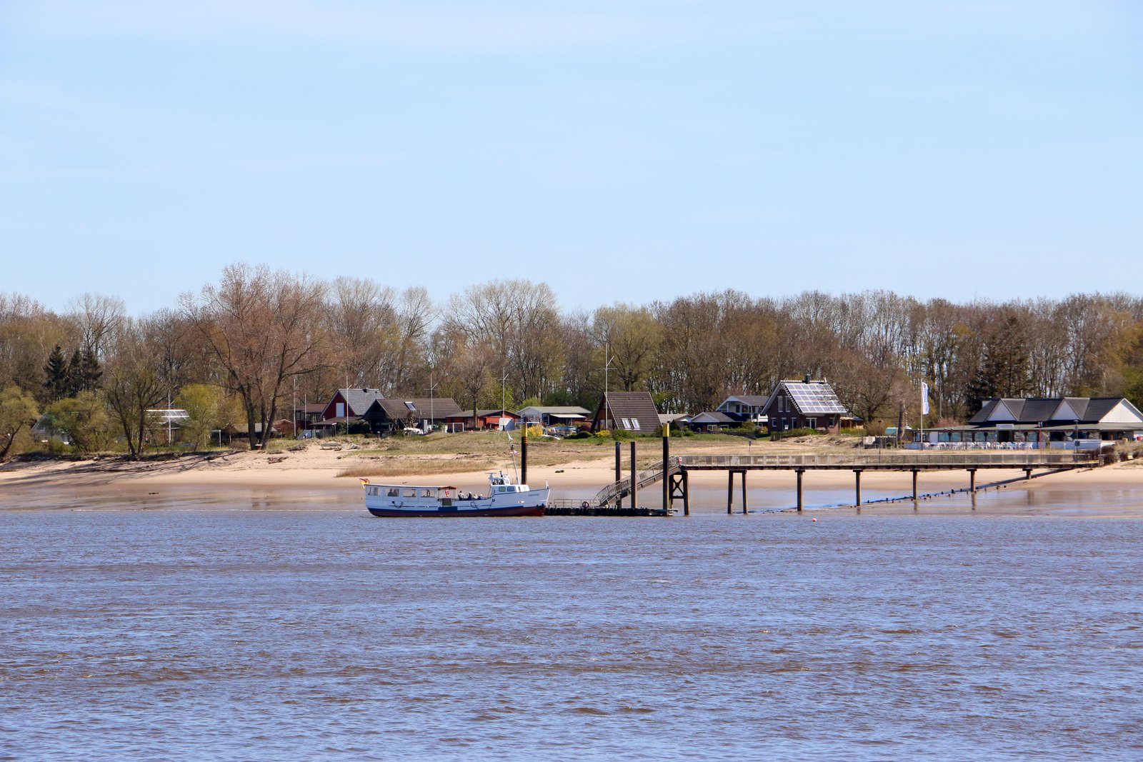
The riverine island Harriersand is eleven kilometers long and is located directly adjacent to the center of Brake. It received ist current form as a result oft he so-called “Weser correction”. Thereby, the Lower Weser was straightened and deepened from Bremen down to the estuary, as it flows into the North Sea near Bremerhaven. In the course of this technical masterpiece, a revolutionary achievement under the direction of Bremen´s Chief Construction Officer, Ludwig Franzius (1832-1903), Harriersand was formed by uniting seven riverine islands along Brake´s coast. Harriersand is now home to 150 holiday cottages, a campsite and many small sand beaches. The ferry "Guntsiet" travels regularly between Brake and Harriersand.
Popular
The Quay of Brake, divided into “Stadtkaje“ (City Quay) and „Heukaje“ (Hay Quay), is one of the more popular meeting points for the citizens of Brake. If one stands along the pier and looks towards the east, by the way, one does not just see the other shore of the Weser, but the riverine island Harriersand as well. Harriersand, a destination highly frequented by people in the Wesermarsch Region, is approximately eleven kilometers long and has an area of about six square kilometers. Created in its current form by man towards the end of the 19th century, Harriersand is one of the longest riverine islands in all of Europe.
Seven Sands make an Island
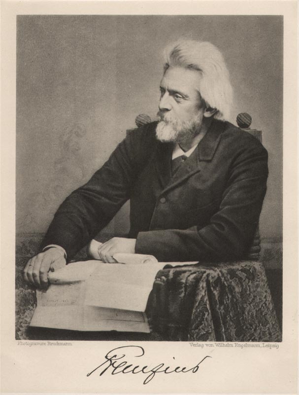 Ludwig Franzius (1832-1903)
Planner of the Weser correction
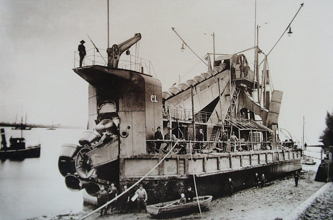
Up until 1887, the Weser was a natural river with numerous serpentines, shallows and a constantly meandering channel. Even the sevens sands which partially surround Brake in the Weser, changed their forms and sizes within the course of time: Nonnenplate, Großer Pater, Kleiner Pater, Osterpater, Westerpater, Harriersand and Wilhelmsplate. The initial Weser correction (1887-1895) was the first step taken towards uniting Nonne, Pater, Harrien and Wilhelm. The straightened river had to be deepened in order to increase the viability of its shipping channel. The dredging spoils of the second (1913-1916) and third (1924-1929) deepening of the river was practically dumped “along the wayside”, between the seven sands. Incrementally, these sands merged to form the island now known as Harriersand. At the time, Brake frequently served as an intermediary stop along the way towards the large emigrant harbors Bremen, Bremerhaven, Cuxhaven and Hamburg. Harriersand functioned thereby as an ideal location for the repair and the caulking of ships, given that the vessels were washed ashore during the high water phase and underpinned. Furthermore, Harriersand was also a quarantine station for sick ship crews who non one wanted in the city, and the quarters were thus regarded to be "a miserable cowshed on an unhealthy Weser island”.
Recreational use in the Course of Time
 Beach Harriersand, 20th century
Since the 1930s, at the latest, Harriersand has been an oasis for waves of people seeking to relax in the summer months. At first, the guests came in their own boats. Today, however, many visitors arrive with the passenger ferry “Guntsiet”, the preferred connection between Brake and the riverine island which belongs to Schwanewede since 1974.
Beach Harriersand, 20th century
Since the 1930s, at the latest, Harriersand has been an oasis for waves of people seeking to relax in the summer months. At first, the guests came in their own boats. Today, however, many visitors arrive with the passenger ferry “Guntsiet”, the preferred connection between Brake and the riverine island which belongs to Schwanewede since 1974.
Only a few people permanently reside on Harriersand. In 2012, barely 75 persons. On the other hand, the island offers guests a choice of around 150 vacation houses, a camping area and individual holiday apartments. Since 1965, a street bridge near Rade enables motorists to reach Harriersand. Many of the weekend houses of the sandy island have been placed on stilts as a means of protection against threatening high water. The yards of the inhabitants are primarily used for agricultural purposes and are therefore located atop mounds.
During the state of low water, the side of the island facing the city functions as a sandy beach for sunbathers, as the beach hall which offers a true harbor panorama. During high water, the island along the Lower Weser, known for its outstanding water quality, serves as an ideal bathing area along the channel of the great freighters.
Experiences in the museum
The first Weser correction and subsequent deepenings have decisively altered the appearance of the river. Harriersand is one of these visible changes. You have a great view of Harriersand from the top floor of the telegraph. Additionally you can learn more about the Weser correction using the Weser model on the ground floor. Another model can be found at "Haus Elsfleth".
Maritime Museum Telegraph, Kaje 8, 26919 Brake - Ground floor & 5th floor
Maritime Museum - "Haus Elsfleth", Weserstraße 14, 26931 Elsfleth - Ground floor